
Tornadoes are among nature’s most violent and awe-inspiring phenomena, capable of immense destruction. These rapidly rotating columns of air, extending from a thunderstorm to the ground, represent a pinnacle of atmospheric instability and powerful energy conversion. For centuries, their unpredictable nature and devastating force have fascinated and challenged meteorologists. A deeper scientific understanding of their formation, classification, and behavior is crucial for improving forecasting, warning systems, and ultimately, saving lives.
Defining the Vortex: What is a Tornado?
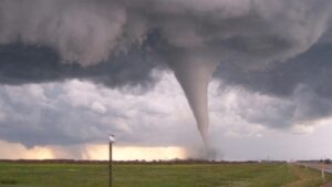
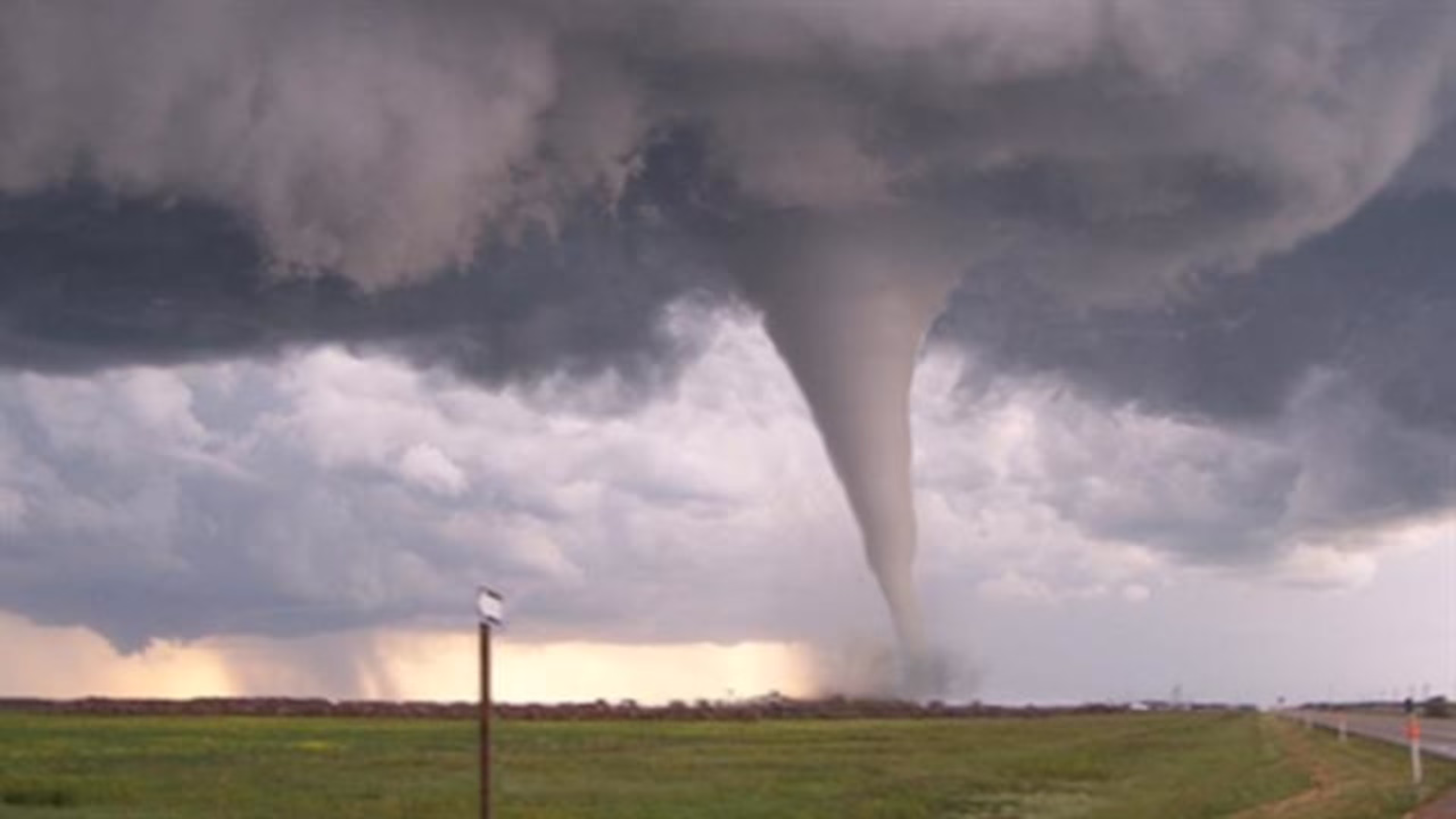
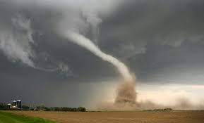
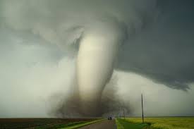
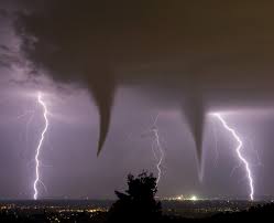
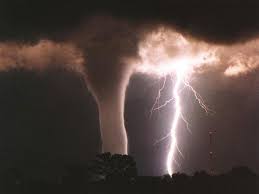
A tornado is a violently rotating column of air in contact with both the surface of the Earth and a cumulonimbus cloud or, in rare cases, the base of a cumulus cloud. They are often, but not always, visible as a condensation funnel. This funnel is composed of water droplets, dust, and debris, and it extends downward from the base of a parent cloud. Tornadoes derive their name from the Spanish word “tronada,” meaning thunderstorm. While colloquially referred to as “twisters” or “cyclones” (though “cyclone” in meteorology refers to a much broader class of rotating storm systems), the term tornado specifically describes this intense, localized vortex.
Their rotation is most often cyclonic in the Northern Hemisphere (counter-clockwise) and anticyclonic in the Southern Hemisphere (clockwise), although exceptions can occur. Tornadoes vary widely in size and intensity, from narrow rope-like funnels to wide, wedge-shaped columns. Their path can be short, dissipating after a few hundred meters, or long, carving a path of destruction for tens or even hundreds of kilometers.
The Genesis of a Tornado: Key Atmospheric Ingredients
The formation of tornadoes is a complex process requiring a specific combination of atmospheric conditions, often associated with powerful supercell thunderstorms. While not all supercells produce tornadoes, they are the most common host. The primary ingredients include:
1. Atmospheric Instability
A highly unstable atmosphere is fundamental. This typically involves warm, moist air near the surface, which is less dense and tends to rise rapidly (creating an updraft). Above this layer, cooler, drier air traps the warm air, building potential energy. When the warm air finally breaks through, it rises explosively, releasing latent heat and leading to powerful thunderstorms.
2. Wind Shear
Wind shear is perhaps the most critical component for strong, long-lived tornadoes. It refers to the change in wind speed and/or direction with height.
- Directional Shear: Wind direction changes with altitude, for instance, southerly winds near the surface and southwesterly or westerly winds aloft. This creates a horizontal rolling motion in the atmosphere.
- Speed Shear: Wind speed increases significantly with altitude. This combination of horizontal and vertical wind shear creates a horizontal tube of rotating air in the lower atmosphere.
3. Lifting Mechanism
For the warm, moist air to rise and initiate thunderstorm development, a lifting mechanism is required. Common triggers include:
- Cold Fronts: Advancing cold air undercuts warm air, forcing it upwards.
- Drylines: A boundary separating moist and dry air masses, where the drier, denser air can lift the moist air.
- Outflow Boundaries: Cold, dense air spreading out from a decaying thunderstorm can lift new warm air.
- Orographic Lift: Air forced upwards by terrain (e.g., mountains), though less common for severe tornadoes.
4. Moisture
Abundant moisture in the lower to mid-levels of the atmosphere provides the fuel for thunderstorms. As moist air rises and cools, water vapor condenses, releasing latent heat and strengthening the updraft.
5. The Role of Supercells and Mesocyclones
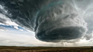
When these ingredients align, especially with strong wind shear, they can foster the development of a supercell thunderstorm. A supercell is a rotating thunderstorm characterized by a persistent and powerful rotating updraft known as a mesocyclone.
- The horizontal rotation generated by wind shear is tilted vertically by the strong updraft within the supercell. This vertical tilting pulls the rotating air upwards, forming the mesocyclone.
- As the mesocyclone intensifies, air rushing into its base to feed the updraft begins to spin faster due to the conservation of angular momentum (similar to a spinning ice skater pulling in their arms). This localized, intense rotation near the ground often leads to the formation of a tornado.
- Simultaneously, a rear flank downdraft (RFD) — a region of cool, descending air — wraps around the mesocyclone. The interaction between the updraft, downdraft, and rotating air at low levels is crucial for intensifying the vortex and bringing it to the surface.
The Tornado Life Cycle
Tornadoes typically follow a predictable, albeit sometimes rapid, life cycle:
- Organizing Stage: A visible funnel cloud descends from the cloud base, but may not yet reach the ground. Dust or debris may be visible swirling on the surface beneath the funnel.
- Mature Stage: The funnel extends fully to the ground, taking on its most destructive form. This is typically the most intense and widest phase of the tornado.
- Shrinking Stage: The tornado begins to narrow and tilt as its supply of warm, moist air is cut off. The circulation may weaken, and the funnel may become thin and rope-like (“rope out”).
- Dissipating Stage: The tornado breaks apart, often appearing as a disorganized, ragged cloud of dust and debris before vanishing. However, a dissipated tornado can sometimes reform.
Classification and Measurement: The EF-Scale
The intensity of tornadoes is measured using the Enhanced Fujita (EF) Scale, which replaced the original Fujita (F) Scale in 2007. The EF-Scale rates tornadoes based on the damage they cause, correlating specific types of damage to estimated wind speeds. It is important to note that the scale measures damage, not direct wind speed, as it’s difficult to accurately measure tornado winds directly in the field.
Global Distribution: Beyond “Tornado Alley”
While the United States experiences the most tornadoes annually (averaging over 1,200), particularly in the region known as “Tornado Alley” (stretching from Texas through Oklahoma, Kansas, Nebraska, and into parts of the Midwest), these powerful storms occur on every continent except Antarctica. Significant tornado activity is also observed in:
- Canada: Especially the Canadian Prairies and Southern Ontario.
- Argentina: The “Tornado Corridor” in the central and northern parts.
- Australia: Particularly the eastern and southeastern states.
- Bangladesh and Eastern India: Often associated with devastating loss of life due to high population density and less robust infrastructure.
- Europe: Parts of the UK, Germany, and Russia.
- South Africa.
The specific atmospheric conditions required for tornado formation are most common in the central U.S. due to the collision of warm, moist air from the Gulf of Mexico, cool, dry air from the Rockies, and cold, dry air from Canada, creating an ideal environment for violent thunderstorms.
Forecasting and Warning Systems
Predicting tornadoes remains a significant challenge due to their small scale and rapid development. However, meteorological advancements have vastly improved forecasting and warning capabilities:
- Doppler Radar: This technology revolutionized tornado forecasting by detecting wind patterns within thunderstorms, including the tell-tale rotation (mesocyclone) that can precede a tornado. Tornado warnings are issued when a tornado is imminent or observed, providing critical minutes of lead time.
- Storm Spotters: Trained volunteers (e.g., from the SKYWARN program in the U.S.) provide invaluable ground truth observations, confirming radar signatures and reporting visual sightings of tornadoes and associated damage.
- Numerical Weather Prediction Models: Sophisticated computer models simulate atmospheric conditions, helping meteorologists identify areas at risk for severe weather days in advance.
- Atmospheric Soundings: Balloons equipped with sensors are launched to measure temperature, humidity, and wind at various altitudes, providing crucial data for assessing atmospheric instability and wind shear.
Despite these advancements, the chaotic nature of atmospheric dynamics means that precise location and timing of tornado formation remain difficult, necessitating robust public awareness campaigns and clear communication channels for warnings.
Research and Future Outlook
 Scientific research into tornadoes continues to evolve, driven by a desire to improve prediction accuracy and mitigate their devastating impact. Ongoing studies focus on:
- High-Resolution Modeling: Developing more powerful computer models that can simulate tornado-scale phenomena, providing better insight into their internal dynamics.
- Dual-Polarization Radar: Newer radar technology that provides more detailed information about precipitation and debris within storms, helping distinguish between hail and actual tornado debris.
- Field Research: Deploying mobile radar units and instrumented vehicles into storms to collect real-time data from close range (e.g., through programs like VORTEX-SE).
- Climate Change Impact: Researchers are investigating whether a warming climate might alter the frequency, intensity, or geographical distribution of tornadoes, though current understanding suggests a complex relationship with no simple answers. While the number of days with tornadoes might decrease, there’s some evidence for more outbreaks with a higher number of intense tornadoes.
The study of tornadoes is a testament to humanity’s ongoing quest to understand and contend with the formidable forces of our planet. As technology advances and scientific understanding deepens, the hope remains that the enigma of these powerful vortices will be further unraveled, leading to more effective warnings and greater safety for communities worldwide.